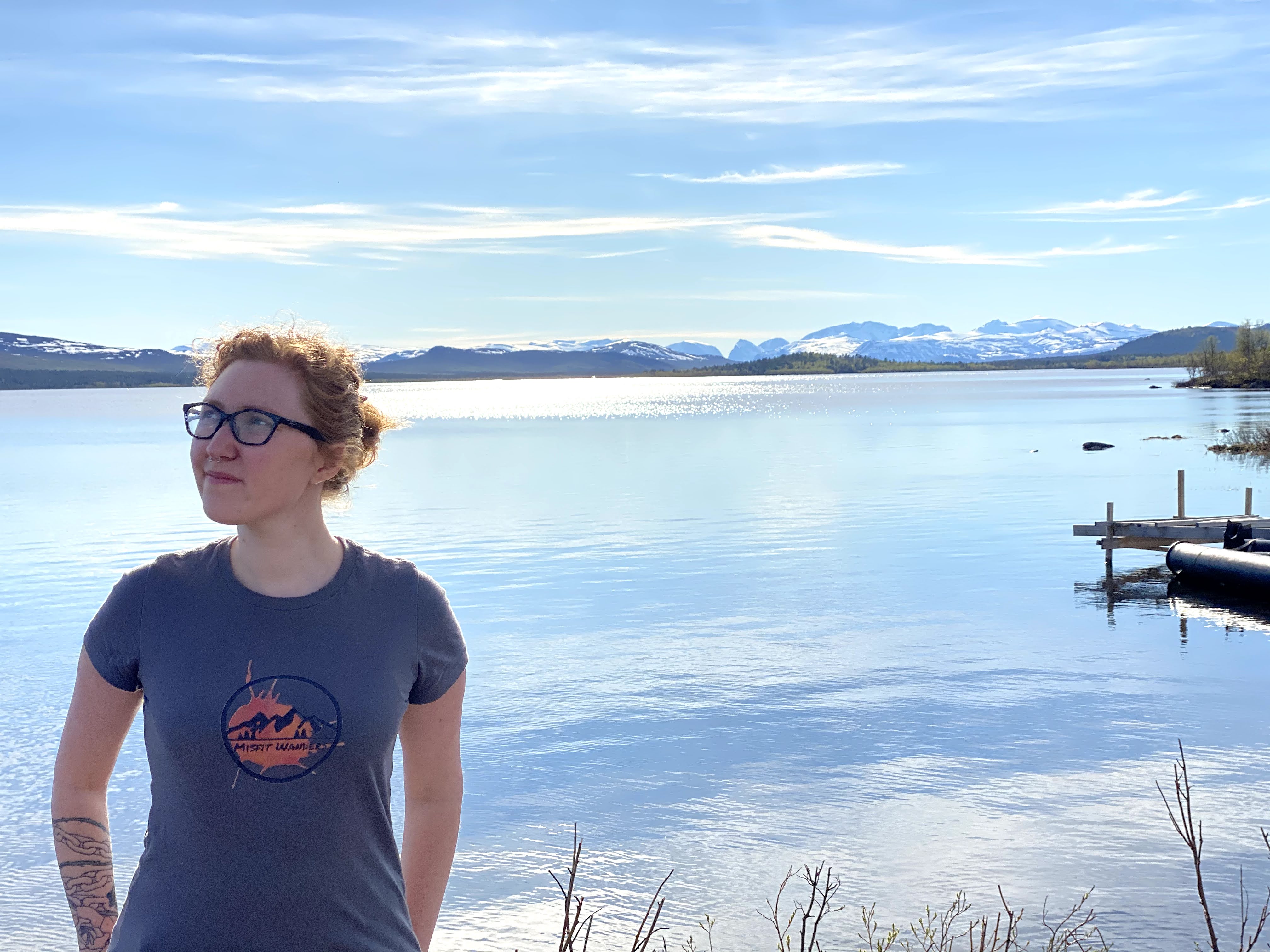

The land had a glow from the sun. I was warm all the way down to my toes after hiking in Varmland. A lot of happy people walked by, and the flowers around us were in full bloom. This place was filled with the beauty of nature. That’s when I learned I loved hiking in Varmland, Sweden, which is where my husband is from. This was the start of our time living in Sweden. It’s been taken over by woods for three years now, and you can walk to a couple of lakes from there. When I walk through the woods, all of my stress goes away. My dog and I go for walks through our backyard several times a day since I have a dog. Going outside to enjoy life with the sound of birds singing is a great way to get rid of stress.
Fun Facts about Värmland:
- A lot of people come to this place to enjoy nature. It is forest on 87% of Varmland.
- In this part of Sweden, there are 10,000 lakes spread out.
- The longest river in Sweden, the Klaralven, flows through the middle of this province. It flows into Vanern, one of Europe’s biggest lakes, which is close to the city of Karlstad.
- This lake has 22,000 islands that make it feel more like the sea than a lake.
Hiking Varmland, a Province in Sweden
Varmland hiking can be different. There are many easy walks in the area that can last anywhere from an hour to a whole day. Some paths are very steep and can last for days, so if you want to push yourself, go for them. In the area, you can see deer, moose, elk, wild pig, wolverines, lynx, wolves, and bears. People will rarely be bothered by the dangerous animals. Some people do see deer and moose, though. To find out more, go to Vandringsleder.se
If you go to Sweden, you should know that the weather can change quickly. If you want to go climbing in Varmland, you should always check the weather and bring a compass or GPS with you. Read about hiking in Sweden to find out more about the weather there.
1. Gettjärnsklätten- Outside of Sunne
Difficulty: Easy-Moderate- Distance: 1 km- 3.3 km (.6- 2 mi.) – Duration: Approx. 30 min.-2 hours- Coordinates: 59.9000° N, 12.9500° E, (Outside of Sunne)- Transport: Rent a car to get to it
Hiking Varmland trails in Gettjärnsklätten
From where you park, the trail goes up 200 meters. The map above is in Swedish, so I’ll explain it for you so you can understand it and use it.
Translation for Map:
- This is a nature walk.
- Reserved Parking: Scheduling Parking
- The Deep Valley Creek in Djupdalsbacken
- It’s the name of a place.
- It’s the name of a place.
- View – View
- Trails on the Vandringsleder
- Nature reserve, or Naturreservat
The map shows that there are several ways to get there. Your choice will depend on where you want to begin your trip and how long you want it to last. To get there and back, it’s best to take a car. It can be anywhere from 1 km to 3.3 km long. If you click here, you can rent a car. The paths are marked, and the terrain isn’t too hard. When you get to the top, you can see a lovely view of the area. You should bring a day pack and a water bottle because the paths don’t go in a circle.
That’s always been my go-to Daypack. I’ve been traveling since 2012 and have always used Osprey bags. They’re made to last, and a lot of them come with a waterproof cover, which is great. Only thing I don’t like about the 24L size is that the spot where I put my water bottle doesn’t have a clip. A lot of water bottles have broken for me because I throw mine around a lot when I travel. Oh no!
Our Hike up to the View
The steep walk of 1 km (.6 mi) took us thirty to forty minutes. It seemed like I was struggling to stay alive! Before we went on our camping trip to Norway, we went on this hike to get ready. Even though my body wasn’t used to the climb, the view at the top made me remember why I love climbing. The breeze kept me cool, and it went away as soon as my body felt tired. I felt alive when I saw that view!

View on top of Gettjärnsklätten
2. Hiking Varmland in Kil around Lake Södra Hyn
Difficulty: Easy- Distance: 12.9 Km (8 mi.) – Duration: Approx. 3.5 hours – Coordinates: 59.4809° N, 13.3960° E (Outside of Kil) – Transport: Rent a car to get here
Varmland is a pretty easy place to hike, and this area includes parts where you walk through fields. Be careful, because part of the hike goes through tall grass, so wear long pants because there are often stinging nettles there! You will be able to walk next to the river Klaralven as you take this path. In the springtime here, flowers bloom and the grass is very green. The road is marked with orange lines that stand out. This path goes in a circle and is pretty easy the whole way.

Trail around Södra Hyn
You should read Walking in Värmland. It’s a great, detailed book about hikes in Varmland, and it’s written in English. That is always a good thing! It comes with 22 routes and useful maps. The picture up top is from the book. We’ve used this on some of our walks in this area. It has been very helpful!

Södra Hyn in Kil
Watery Hiking Varmland in the Fall Time
As we walked along this path, things got crazy. We started this trip on a day when the snow was melting… We had to walk through some puddles because of this. The path became less interesting because of it. But we’re going to try it again in the spring. It will be fun to see all the animals and trees in this beautiful area.

3. Hiking Varmland Around Lake Vågsjörna in Munkfors
Difficulty: Easy- Distance: 7 Km (4.3 mi.) – Duration: Approx. 2.5 hours – pic. Of trail- Coordinates: 59° 48.554 N, 13° 34.244 E (In Munkors) – Transport: Rent a car to get here
If the weather is nice, this path is a great place to have a picnic or go swimming. It’s easy to walk on the road that goes around and back. The green and white-marked path will take you through Swedish woods to a dock. In some places along the trail, you can see the makeshift tracks that Swedes built so that hikers could easily use them.

Swedish Summer House
You can’t help but see Swedish red houses when you’re there. This path takes you to one of their red homes. They started using this paint on the wooden houses to help keep them in good shape. It came from copper mines in Dalarna in the beginning. As early as the 1600s, people did this. It’s now more of a custom. For your hike in Varmland, don’t forget to bring a good water bottle. Always be ready for a walk, no matter where you go. Pack a GPS and a friend with you if you’re not sure about the path. A scarf is something that I’ve found to be useful. It can keep your hair out of your face or keep you warm when it’s cold outside. So many uses!

Trail around lake Vågsjörna

Sundsbergsleden Sign
4. The Town Sunne in Sweden!
This is a hike in the town where I live! Being surrounded by nature is great, and this is one of the best places to be among trees. These paths are well marked and lead to different places. You can start these paths near Selma spa. There are signs up that tell you more about the trails.
Some parts of the road take you through forests that make you feel like you’re not near any towns. You can feel like you’re in town and in the woods at the same time on these loop roads. In the event that you choose to hike during the wet season, remember to bring a rain jacket. I suggest a marmot rainjacket. They’re strong and will last for years. It still works great after 5 years that I’ve had mine. You can also pick from different colors.

Sundbergsleden pathway and me
Go to Varmlandsleder to download a map of this trail.
If you have any questions about this area, you can reach help here.
Sunne Tourism: turist@sunne.se +46 (0)565 164 00
5. Brattfallet and Halgaleden
Difficulty: Difficult – Distance: 6.8 Km (4.3 mi.) – Duration: Approx. 4 hours – Coordinates: N 60° 17.624 E 13° 28.092 (North of Ekshärad)- Transport: Rent a car to get here
This walk will take you to a waterfall. It looks very different when the water hits the red rocks. It will be open on May 15th and is in Hagfors. There are signs to help you find your way. The best times to see the waterfall are in the spring or winter. This is where you can tap the map here. You can go on any kind of hike you want in Varmland. You just need to know where to look for them.
This trail is tougher than the others, so make sure you wear boots that can last. I really think you should get waterproof Salomon boots. Mine have been around for years, but lately I’ve been having trouble with them being waterproof. But they lived longer than I thought they would. My husband showed me how important shoes are when you’re hiking in the woods. I will never wear $20 shoes again. I did that once and walked them to death! The path I was on went on for a whole day and it was really hot. My shoes got warm! I had to walk out of that canyon the next day with burned bottoms on my shoes. What a trip!

Brattfallet and Halgaleden
If you have any questions or need help, you can reach Hagfors community.
Contact
Hagfors-Ekshärad tourist information: turist@hagfors.se
Telephone: +46 (0)563 187 50
Värmland Information:
You can read about Hiking in Sweden if you want to learn more about the country and the outdoors. You can look for Berries or mushrooms in some great places. Swedes even have a rule that lets people roam freely in nature. The article Hiking in Sweden has more information on these topics.

Check out Hovfjallet Nature Reserve if you like to hike in Varmland. It’s a lovely spot with great hiking tracks close to Torsby! Find out more here. You can enjoy this spot all year round because theHovfjället Ski Resort is nearby. You can ski, ride snowmobiles, and do other things here. Find out more about Hovfjället. Also, the page Hiking in Sweden has more information about hiking trails in Varmland.
Pin it on Pinterest!


I may get a commission on many of the items that I recommend. But this doesn’t change the price for you!