
When I get to some of the best tracks in Karlstad, the trails are full of people. As people walk along the paths, I feel filled with happiness. There are several parks in the area, and nature is right on the edge of the city. Because they live like “Swedes,” they need nature to be happy. It’s a lot easier to get around the city now that you can rent bikes. You can also use their public transportation system, which runs on smooth roads.
The county center is Karlstad. Varmland is also known as the forest county. Of course, this place will have a lot of great tracks. I’ve been on many of the streets and trails because I’ve lived in Varmland for five years and Karlstad is only an hour’s train ride away. The city is in the middle of the river Klaralven. After that, you can take a ship or a boat through the city. As you walk around this area, you might see people lying in the sun on their library or community house. This little city is known for having some of the most sunny days in all of Sweden. Come hike here and enjoy the sun!
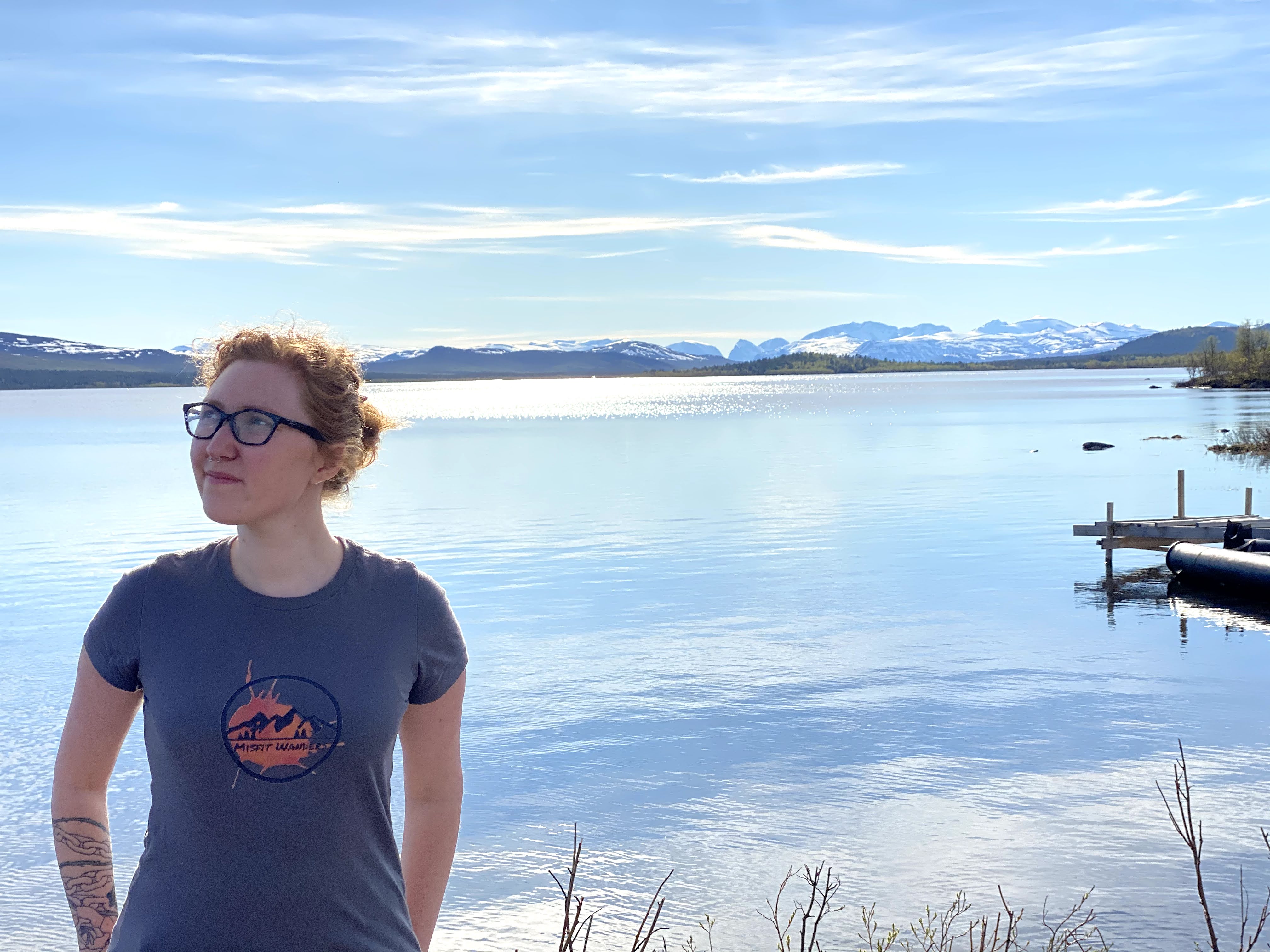
Looking for Hiking in Sweden? Check it out if you want to travel through Sweden or just enjoy the outdoors. Find out more about the Swedes and how they get around in nature in this piece.

1. Mariebergsskogen
Difficulty: Easy – Distance: 1 km- 3.3 km (.6- 2 mi.)- Duration: Approx. 30 min.-2 hours- Coordinates: 59.3699° N, 13.4871° E- Address: Treffenbergsvägen, 652 29, Karlstad – Transport: Bus, walk, or Rent a car
By the time I got to Mariebergsskogen, I could see how beautiful the river next to it was. The day was nice for a hike in Karlstad’s city park because the sun was out. You can do many things here, and people of all kinds can enjoy them. Where else would be a better place to go with the family? If you don’t mind all the other people, start your trip on one of the trails outside the park. As you walk along the roads, you might not even feel like you’re in a city. That’s why this track is one of the best in Karlstad! A lot of the tracks connect to each other, which makes it easy to walk on more than one.
How to get there
Take bus 12 from Karlstad Central (train station) and it brings you right to Mariebergsskogen. Nice and easy!

From Mariebergsskogen website
2. I-2
Difficulty: Moderate – Distance: 1.8 km- 3 km (1.1- 1.9 mi.) – Duration: Approx. 1 hour -2 hours- Coordinates: 59.3909° N, 13.4819° E- Address: Säterivägen 8, 653 41 Karlstad – Transport: Bus, walk or Rent a car
As we began our hike through this area, I caught a glimpse of something far away. As I got closer, I saw that it was a Swedish sign. It was a game for the kids who walked these paths to keep them busy. These trails were clearly marked and simple to find. People can have picnics and cook food in certain areas. There are also routes set aside for jogging in this area.
Keep an eye out! On some Saturdays of the year, they use this area as a gun range and let people hunt there as well. But those only happen a few times a year on Saturdays. Stop at one of the resting spots on one of the best walks in Karlstad to take a break. You can take a bus or walk the 2 km (1.2 mi) from Karlstad C to this place. Renting a car lets you get to places that are harder to get to and that you can’t get to with public transportation and hiking boots alone.
How to get there
You can take bus 6 from Karlstad C, which brings you to Tingvalla isstadion. You just have 290 meters left to the park. Or you can drive from Karlstad Central.
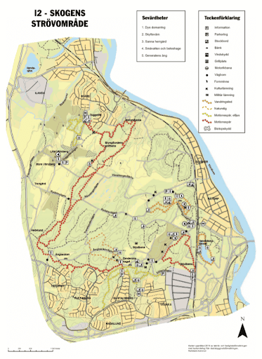

I-2 map from Karlstad website and Directions
3. Skutberget
Difficulty: Easy- Difficult – Distance: 800m- 22km (.5- 13.7 mi.)- Duration: Approx. 15 min – 15 hours – Coordinates: 59.3744° N, 13.3875° E- Address: Skutbergsvägen 159, 653 46, Karlstad – Transport: Bus or Rent a car
When I went to Karlstad in the winter, the sun came out for a short time. My smile got bigger. Today is a good day to go hiking. We got in my car and drove toward Skutberget. My best friend is my dog, Clyde. It’s nice to walk along the road next to the lake. At the start, you’ll be able to enjoy a clean beach. That spot is worth the walk because it has a great view of Lake Vanern.
Since I was already on the trail, the Alltrails app told me that there are a lot of other trails in the area. In the end, we did some of the paths that link. All of the paths led back to the beginning, so it was easy to hike back. People on bikes and joggers passed us as we walked. A bike path of 8.5 km (5.3 mi) and a path for running are there. But you can walk on any of these great Karlstad trails.
I felt warm all the way through, it was a nice day! At first, we stuck to the path next to the river. The ground was made of stone! Still, trees and bushes were growing off of it, which made it even more amazing. The plants there are lovely and make you feel welcome. They have places to camp, play disc golf, park, rest on some of the trails, and cook. They have a bathroom too! Yes, I said it: a bathroom!

Skutberget

Skutberget Beach
How to get there
To get there, you can take bus 1 and it will take you right there! The ride is about 30 minutes.

Bus Map to Hammars Udde from Google Maps
4. Hammars Udde
Difficulty: Easy- Moderate – Distance: 1km- 10km (.6-6.2 mi.) – Duration: Approx. 15min.- 6 hours- Coordinates: 59.3485129 N, 13.5210465 E- Address: 663 41 Hammarö, Karlstad – Transport: Bus, walk, or Rent a car
There are a number of trails in this area. Pilgrimsleden, which means “the Pilgrim trail,” is the better known one. The trail is 1 km (.6 mi) long here. The name of another one in this area is mormospåret. It’s about 2.5 km (1.5 mi) long, and the trees have marks on their wood. In Kilenegarden, there are even more trails. They range from 1 to 10 km (0.6 to 6.2 mi), check it out! These are some of the best trails in Karlstad, and it’s nice to see them.
It is best to have good hiking boots when you walk in this area. A bad pair of shoes on a hike made me understand how important GOOD shoes are! I’ve had these great Oboz hiking boots for about 5 years now. Take a look!
5. Kycklingleden
Difficulty: Moderate – Distance: 5.7 km (3.5 mi.)- Duration: Approx. 2 hours- Coordinates: N59° 15.683, E13° 5.592- Address: Unnamed Road, 660 40 Segmon- Transport: Rent a car

Kycklingleden trail
Its name comes from the words “Chicken Trail.” You can follow this path close to Lake Vanern and climb a mountain to get a great view of the largest lake in Western Europe. Some people might find this path a little hard because it goes up and down. There are even spots where ropes are used to get up steep parts. This is a loop trail in the Grums neighborhood, which is right next to Karlstad city.
There are some of the best trails in Karlstad in this neighborhood. You can only get here by renting a car.
If you want to know more about the trail check out my article, Kycklingleden Trail – A Nice Hiking Trail Outside of Karlstad.

Kycklingleden Trail
How to get there
Take highway E18/E45 to Grums. Take the exit Liljedal. Stay on the road for 4.5 km. Cross a bridge, then take the first road to the left, Budavägen. Follow this road for 1km, when the road forks, keep to the left. At Buda Farm, keep to the right. You made it!
6. Jäverön
Difficulty: Moderate – Distance: 3-17 km (1.9-10.6 mi.)- Duration: Approx. 1-8 hours- Coordinates: 59.3667° N, 13.6333° E – Address: 656 71 Skattkärr – Transport: Ferry, Bus, bicycle, or rent a car
This island is both a nature area and a place where people feel welcome. There are three different walks here, ranging from short to long. They have bathrooms and houses for people who come to visit. Another great thing about this road is that there are great places to stop along the way. Have a picnic in the sun with food that you bring with you. You can bus, boat, or ferry here. You can rent a car or a bike and take either on the boat.
How to get there
From Karlstad bus station, you can take the 501 bus that runs daily to get to it.
Other trails in Karlstad:

Trails on Javeron Island

Hiking in Sweden
Sweden is the best place to be if you like to hike. This place has a lot of different hikes, from the more challenging Mount Kebnekaise hike to the calmer Tiveden National Park trip. My page called HHiking in Sweden has more information about all the different hikes you can do in Sweden.
")
Pin it on Pinterest!

Any products I recommend, I make a commission. This doesn’t change the price, so you’re paying the same.
Or to find out about more Hiking blogs out there, check out Top 100 Hiking Blogs.